Viewlity V2.0 - Diploma Project
1. Overview
Viewlity is an Augmented Reality Engine for showing nearby points of interest on your Android phone. It's a powerful, easy-to-use tool for discovering places around you, finding the nearest fuel stations, coffee-shops, restaurants, ATMs, subway stations, places of worship and many other points of interest. You can also locate them on Google Maps, in order to get a larger point of view.
The experience of Viewlity is a different story for each user. By just looking though the camera and moving your Android phone left or right, Viewlity enriches the world that surrounds you.
1.1 Project goal
This project is developed as part of my diploma thesis. The AR (augmented reality) engine was earlier developed during Android Summer School at Politehnica University of Bucharest. You can read all about it here. On top of that, I added a few features that would allow the project to move further.
One feature that was really necessary in the earlier version was the ability to receive real-time updates for locations, when moving the phone around for more than just a couple of meters. Also, an integration with social networks would allow many new development possibilites, like allowing the user to see where his friends have checked in. In this release, I used the places API from Foursquare, Google Places and Facebook Places in order to grab locations in real-time.
1.2 Screenshots


2. Application Behavior
The application is definitely one of the easiest you've used. Here are 3 steps:
- Start the application. It will show a splash screen, after which the camera will be started.
- Move the phone around. Point it to North, South, move it left or right and see locations near you.
- Rotate the phone to point the screen upwards and it will scroll the entire list of POIs.
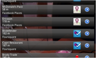
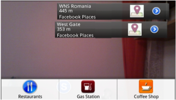
- Oriented locations. Each location is identified by its name, distance to it, and angle to which the phone must be oriented so the location appears in front of the camera.
- Ordered POIs. Every list of locations in Viewlity is ordered by distance from the phone. We know that locations which are closer are far more important, so we'll show them first.
- Clickable POIs. A click will drive you to Google Maps, where you will find the POI that you clicked on, along with the entire list pinned on the map.
- Smooth Animations. You will find that POIs have a very smooth movement, and you can stop and capture each one on the screen. Scrolling through the entire list of locations is very accurately controlled by your phone orientation.
- Real-time updates. Whenever you move your phone by far than just a few meters, you will notice it will update the locations with POIs from Facebook, Google or Foursquare
3. Development
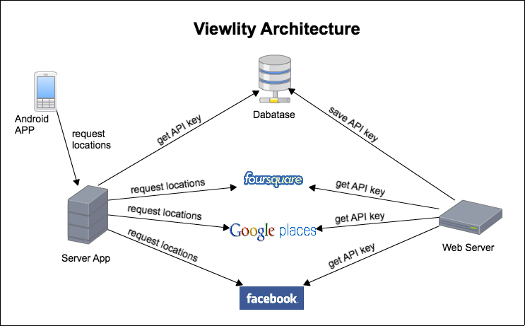
Viewlity architectural model is formed from the following components:
- Web Component
- Server Application
- Client Application
- Database
- GPS Provider Services

- Web Component
- Server Application
- Client Application
- Database
- GPS Provider Services
- Automatic re-sync with the GPS provider
- Larger set of categories
- View your friends
